Spar
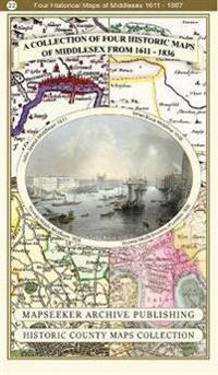
Middlesex 1611 â?? 1836 â?? Fold Up Map that features a collection of Four Historic Maps, John Speedâ??s County Map 1611, Johan Blaeuâ??s County Map of 1648, Thomas Moules County Map of 1836 and a Map of the Environs of London 1836.
This folded map (890mm x 1000mm when unfolded) is an ideal souvenir for tourists to Middlesex and also a valuable reference resource for local and family history research. It includes 4 Historic maps of Middlesex.
- Forfatter
- Mapseeker Publishing Ltd.
- ISBN
- 9781844918454
- Språk
- Engelsk
- Vekt
- 104 gram
- Utgivelsesdato
- 4.1.2019
- Forlag
- Historical Images Ltd
- Antall sider
- 1
