Spar
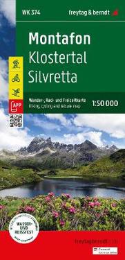
Montafon - Klostertal - Silvretta Hiking, Cycling & Leisure Map
The Montafon hiking, cycling and leisure map offers detailed information about the hiking and cycling trails in Montafon, Klostertal and the Silvretta. With the hiking and cycling map you can ideally plan your tours and find out about the sights along the route. Information on the Montafon hiking and cycling map 1:50,000 Hiking and long-distance hiking trails Mountain bike and cycle paths Ski route, cross-country ski trails Roth app Waterproof and tear-resistant 82 x 90 cm, double-sided Rother App The linked free version of the Rother App offers a digital map with the complete hiking trails as well as some sample tours in the region (free registration required). Waterproof and tear-resistant So that the Montafon hiking map can be used for orientation even on rainy days, it is printed on a special waterproof and durable paper. Manufactured to conserve resources The card consists of 80% ground limestone. The production is much more resource-efficient than conventional paper because the consumption of water, wood and energy is significantly lower.
- ISBN
- 9783707923384
- Språk
- Engelsk
- Vekt
- 103 gram
- Utgivelsesdato
- 15.5.2024
- Forlag
- FREYTAG-BERNDT
- Antall sider
- 1
