Spar
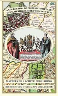
Cambridgeshire 1611 - 1836 - Fold Up Map that includes Four Historic Maps of Cambridgeshire, John Speed's County Map of 1611, Johan Blaeu's County Map of 1648, Thomas Moule's County Map of 1836 and Thomas Moule's Plan of Cambridge City 1836
This folded map (890mm x 1000mm when unfolded) is an ideal souvenir for tourists to Cambridgeshire and also a valuable reference resource for local and family history research. It includes 4 Historic maps of Cambridgeshire
- Forfatter
- Mapseeker Publishing Ltd.
- ISBN
- 9781844918157
- Språk
- Engelsk
- Vekt
- 102 gram
- Utgivelsesdato
- 15.5.2013
- Forlag
- Historical Images Ltd
- Antall sider
- 1
