Tallenna
Rocky Mountain National Park
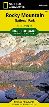
The Rocky Mountain National Park Trails Illustrated map is the most comprehensive recreational map for Colorado's Rocky Mountain National Park. Coverage includes Rocky Mountain National Park, Arapaho and Roosevelt National Forest, Never Summer Wilderness, Arapaho National Recreation Area, and the cities of Granby and Estes Park. The map's shaded relief makes it easy to see the lay-of-the-land, and it has a full UTM grid so you can use it with your GPS. A necessity for exploring in the outdoors, this map is also printed on waterproof, tear-resistant material.
- Alaotsikko
- Trails Illustrated National Parks
- Kirjailija
- National Geographic Maps
- Painos
- 2022nd ed.
- ISBN
- 9781566953429
- Kieli
- englanti
- Paino
- 91 grammaa
- Julkaisupäivä
- 2.8.2012
- Kustantaja
- National Geographic Maps
- Sivumäärä
- 1