Tallenna
John Muir Trail (topographic Map Guide)
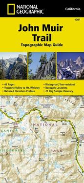
National Geographic's Map Guide of the John Muir Trail is an indispensable tool for navigating one of the most famous trails in the United States. The maps start at the northern terminus in Yosemite Valley and progress along the ridge of the Sierra Nevada, past Devils Postpile, and end at the highest point in the lower 48 on the top of Mount Whitney. Along the way you will pass through; Yosemite National Park, Ansel Adams Wilderness, Devils Postpile National Monument, John Muir Wilderness, Kings Canyon National Park, and finally, Sequoia National Park & Mt Whitney.
- Alaotsikko
- National Geographic California
- Kirjailija
- National Geographic Maps
- Painos
- 2024th ed.
- ISBN
- 9781566956895
- Kieli
- englanti
- Paino
- 94 grammaa
- Julkaisupäivä
- 26.9.2014
- Kustantaja
- National Geographic Maps
- Sivumäärä
- 1