This first edition of South China Sea is the successor to Stephen Davies and Elaine Morganââ?¬â?¢s Cruising Guide to Southeast Asia, Volume I (Imray). Building on the earlier …
At a scale of 1:7,620,000 this chart covers the North Atlantic from Brazil to Newfoundland and Gibraltar to the Caribbean. It has been constructed on a conical projection that …
karta, falsad., 2018, Engelska, ISBN 9781786790422
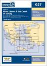
Plans included:Ayvalik (Turkey) (1:75 000)Sigri (N. Lesvos) (1:30 000) Entrance to Kolpos Kalloni (N. Lesvos) (1:30 000)Entrance to Kolpos Yeras (N. Lesvos) (1:40 000)Mitilini (N. …
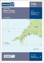
Plans included:Continuation to Lostwithiel (1:20 000)First edition. Part of the small format Y series (A2 size), this replicates sheet 2400.7 from the 2400 West Country Chart Pack
karta, falsad., 2021, Engelska, ISBN 9781786792662
This edition includes the latest official UKHO data combined with additional information sourced from Imray's network to make it ideal for small craft. It includes the latest …
karta, falsad., 2019, Engelska, ISBN 9781786791313
Plans included:Baie de Lampaul (Ouessant) (1:30 000)Port du Conquet (1:20 000)Port de BrestMarina du Moulin Blanc (1:30 000)Marina du Moulin Blanc (1:9000)L'Elorn - Continuation to …
karta, falsad., 2021, Engelska, ISBN 9781786792501
On this edition the magnetic variation curves have been updated with 2020 data. Under new royalty terms, the DGA (Danish Geodata Agency) have made it unviable to reproduce their …