Filter
- Scribner book company (3)
- Dorling kindersley ltd (17)
- Penguin books ltd (38)
- Cambridge university press (441)
- Yale university press (20)
- Gill (2)
- Harpercollins publishers (80)
- Vintage (4)
- Bloomsbury publishing plc (43)
- Bodleian library (9)
- Quarto publishing plc (10)
- Scholastic (4)
- Pan macmillan (9)
- Amber books ltd (6)
- Broadman holman publishers (2)
- Dk (4)
- Oxford university press (76)
- Black cat (1)
- Horrible histories (2)
- Atlas (5)
- Cambridge library collection - polar exploration (116)
- Dk history map by map (4)
- Oxford world's classics (1)
- Routledge historical atlases (7)
- Atlases of the imagination (2)
- Dk history changers (2)
- Unexpected atlases (1)
- New directions in sustainability and society (1)
- Cambridge library collection - hakluyt first series (27)
- Lse international studies (2)
- An account of the arctic regions 2 volume set (1)
- Tauris historical geographical series (5)
- Mapping the past (3)
- Rewriting histories (1)
- Academia sinica on east asia (1)
- A short history of the world (1)
Historisk geografi
Filter
-

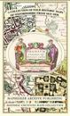
Oxfordshire 1611 - 1836 - Fold Up Map that features a collection of Four Historic Maps, John Speed's County Map 1611, Johan Blaeu's County Map of 1648, Thomas Moules County Map of 1836 and a Plan of Oxford 1836 by Thomas Moule. The maps also feature a number of Oxfords famous historic buildings.
av Mapseeker Publishing Ltd.
-
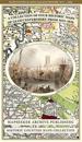
Gloucestershire 1611 – 1836 – Fold Up Map that features a collection of Four Historic Maps, John Speed’s County Map 1611, Johan Blaeu’s County Map of 1648, Thomas Moules County Map of 1836 and a Plan of Gloucester 1805 by Cole and Roper. The maps also feature three historic views of Gloucester from the 1840’s.
av Mapseeker Publishing Ltd.