Sökt på: gis and
totalt 6 703 träffar

Building Web Maps and Apps with ArcGIS Online
ArcGIS Online integrates with so many web apps as well as the ArcGIS Desktop package that it can become a daunting task to set up and manage it all. This book has written …

GIS for Air Search and Rescue

Biology and GIS Based Mapping of Common Dolphinfish
This publication will deliver information on distribution, abundance and biology of Common Dolphinfish which will be useful to know the spawning season for suggesting conservation …

Urban planning for Coimbatore city using Remote sensing and GIS
Urbanization is the quick change of human social roots worldwide, where the urban culture is rapidly replacing village culture. It is the processes through which the forests, …

International Perspectives on Teaching and Learning with GIS in Secondary Schools
This, the first publication to collate a broad international perspective on the pedagogical value of GIS technology in classrooms, offers an unprecedented range of expert views on …

Biology and GIS Based Mapping of Common Dolphinfish

Computational Methods and GIS Applications in Social Science - Textbook and Lab Manual
This set includes the third edition of Computational Methods and GIS in Social Science and the accompanying lab manual. It integrates GIS, spatial analysis, and computational …

Using Space Techniques and GIS to Identify Vulnerable Areas to Natural Hazards along the Jeddah-Rabigh Region, Saudi Arabia
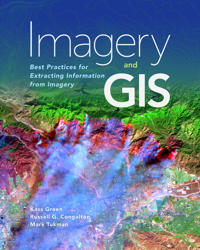
Imagery and GIS
Imagery and GIS, working together, expand our perspective so that we can better perceive and understand The Science of Where™. Today, most maps include imagery in the form of …

Marine and Coastal Geographical Information Systems
Marine and coastal applications of GIS are finally gaining wide acceptance in scientific as well as GIS communities, and cover the fields of deep sea geology, chemistry and …

Forensic GIS
A variety of disciplines and professions have embraced geospatial technologies for collecting, storing, manipulating, analyzing and displaying spatial data to investigate crime, …

Integrating Scale in Remote Sensing and GIS
Integrating Scale in Remote Sensing and GIS serves as the most comprehensive documentation of the scientific and methodological advances that have taken place in integrating scale …