Sökt på: map publishers
totalt 4 120 träffar

County of Sussex 1611 - 1836 - Fold Up Map that features a collection of Four Historic Maps, John Speed's County Map 1611, Johan Blaeu's County Map of 1648, Thomas Moules County Map of 1836 and a Plan of the City of Brighton from 1851 by John Tallis. The maps feature a number of vignette views from the period including Brighton's Chain Pier.
This folded map (890mm x 1000mm when unfolded) is an ideal souvenir for tourists to Sussex and also a valuable reference resource for local and family history research. It includes …

Low Fodmap Food Diary: Daily Diary to Track Foods and Symptoms to Help Improve Ibs, Crohn's, Celiac Disease and Other Digestive Disorders
This food diary is perfect to help keep track of your food intake and symptoms each day to help with the low FODMAP diet. With the help of the daily food tracker you can compile a …

Statehood Quarters Collector's Map: Plus the District of Columbia and United States Territories
New Compact Size Display your quarter collection in this educational Collector Map. Archival safe board with openings for all 50 states plus all of the U.S. trust territories & …

Fifty Photographic Views of Plymouth
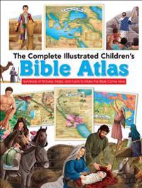
The Complete Illustrated Children's Bible Atlas: Hundreds of Pictures, Maps, and Facts to Make the Bible Come Alive
Help Your Child Explore the Wide World of the Bible Based on the bestselling title, The Complete Illustrated Children's Bible (over 140,000 sold), comes this amazing atlas that …

Walsall Town 1824 - Old Map Supplied Rolled in a Clear Two Part Screw Presentation Tube - Print Size 45cm x 32cm

The Map of Time
An epic, ambitious and page-turning mystery that will appeal to fans of The Shadow of the Wind, Jonathan Strange and Mr Norrell and The Time Traveller’s Wife London, …

NC500 Pocket Map
Explore new places with handy pocket maps from Collins. Published in partnership with © North Coast 500 Ltd, this is the ultimate map to plan your trip of a …

2027 Collins Road Map of Scotland
Explore Scotland with easy-to-read mapping from Collins. Full-colour map of Scotland at 8.7 miles to 1 inch, with clear road network and administrative areas shown in …

Scotland Pocket Map
Discover new places with handy pocket maps from Collins. Fully updated and very detailed for its size, this is a full-colour, double-sided map of Scotland. Showing the …

Collins London Handy Street Map
An essential companion for when you are travelling around London. Clear and easy-to-read map of central London and surrounding area. Contains detailed mapping, presented …

Collins Road Map of Europe
Discover new places in Europe with easy-to-read mapping from Collins. A fully revised and updated colour road map of Europe at a scale of 79 miles to 1 inch / 50km to 1cm …