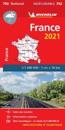
Updated annually, MICHELIN National Map France High Resistance will give you an overall picture of your journey thanks to its clear and accurate mapping scale 1:1 000 000 Our map …
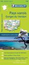
Michelin's Zoom collection are characterized by the high precision of their detailed scale, specially adapted for very touristy areas or with a high density road network, including …
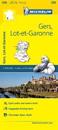
(Edition updated in 2016) The MICHELIN Gers, Lot-et-Garonne local map, scale 1/150,000 is the ideal companion to fully explore this popular area of France and provides star-rated …
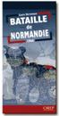
A superb map of the progress of the front line in Normandy from the initial landings in June 1944 through to August 24, 1944. The locations and movements of all the allied units …
(Edition updated in 2018) The MICHELIN Eure, Seine-Maritime local map, scale 1/150,000 is the ideal companion to fully explore these French local areas and provides star-rated …
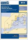
On this 2017 edition the latest depth surveys have been applied. The harbour plan of Roses has been replaced by a new harbour plan of Golfe de Fos. The chart specification has been …
(Edition updated in 2016) The MICHELIN Alpes-Maritimes local map, scale 1 / 150 000 is the ideal companion to fully explore this French local area and provides star-rated Michelin …