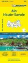
karta, falsad., 2024, Engelska, ISBN 9782067262942
(Edition revised in 2023) The MICHELIN Alpes-de-Haute-Provence, Hautes-Alpes local map, scale 1/150,000 is the ideal companion to fully explore the French alps and provides …
Michelin local maps are on a scale of 1:150,000 up 1:220,000 with easy to read mapping using satellite images. With additional tourist information, these maps are ideal for …
(Edition updated in 2019) The MICHELIN Calvados, Manche local map, scale 1/150,000 is the ideal companion to fully explore the coastal part of Normandy and provides star-rated …
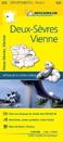
karta, falsad., 2024, Engelska, ISBN 9782067262553
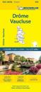
(Edition revised in 2023) The MICHELIN Drome, Vaucluse local map, scale 1/150,000 is the ideal companion to fully explore these Southern areas of France and provides star-rated …
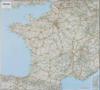
Updated annually, MICHELIN National Map France High Resistance will give you an overall picture of your journey thanks to its clear and accurate mapping scale 1:1 000 000 Our map …
karta, falsad., 2024, Engelska, ISBN 9782067262874
(Edition revised in 2023) The MICHELIN Calvados, Manche local map, scale 1/150,000 is the ideal companion to fully explore the coastal part of Normandy and provides star-rated …
Michelin's Road to liberty Map 105 covers the region associated with France's liberation between June 1944 and January 1945, at a scale of 1:500,000. This is a reprint of the 1947 …
karta, falsad., 2024, Engelska, ISBN 9782067261341
Updated annually, MICHELIN National Map Northwestern France 706 will give you an detailed picture of your journey from Amiens to Brest and La Rochelle to Clermont-Ferrand thanks to …