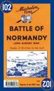
Michelin Battle of Normandy Map 102 covers the region associated with the Battle of Normandy between June and August 1944, at a scale of 1:200,000. Historic WWII reproduction map. …
In French and in English, one side shows the position of the different armies and the progression of the Battle of Normandy. The other side features a photograph which shows the …
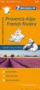
(Edition updated in 2016) MICHELIN Provence-Alps-French Riviera Regional Map scale 1/200,000 will provide you with an extensive coverage of primary, secondary and scenic routes for …
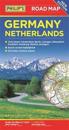
Philip's latest super-clear, double-sided road map of Germany and the Netherlands fully updated with the latest tourist, heritage and driving information.
MICHELIN National Map Southwestern France 708 will give you an detailed picture of your journey from Bayonne to Montpellerand La Rochelle to Clermont-Ferrand thanks to its clear …
Michelin's Zoom collection are characterized by the high precision of their detailed scale, specially adapted for very touristy areas or with a high density road network, including …
(Edition updated in 2020) The MICHELIN Gironde, Landes local map, scale 1/150,000 is the ideal companion to fully explore this popular area on France's atlantic coast and provides …
(Edition updated in 2018) The MICHELIN Alpes-de-Haute-Provence, Hautes-Alpes local map, scale 1/150,000 is the ideal companion to fully explore the French alps and provides …