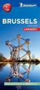
Discover Brussels by foot, car or bike using Michelin Brussels City Plan (scale 1/15,000 cm). In addition to Michelin's clear and accurate mapping, this city plan will help you …
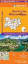
Michelin local maps are on a scale of 1:150,000 up 1:220,000 with easy to read mapping using satellite images. With additional tourist information, these maps are ideal for …
(Edition updated in 2019) The MICHELIN Calvados, Manche local map, scale 1/150,000 is the ideal companion to fully explore the coastal part of Normandy and provides star-rated …
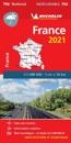
Updated annually, MICHELIN National Map France High Resistance will give you an overall picture of your journey thanks to its clear and accurate mapping scale 1:1 000 000 Our map …
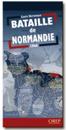
A superb map of the progress of the front line in Normandy from the initial landings in June 1944 through to August 24, 1944. The locations and movements of all the allied units …
Michelin National Map Series help you easily plan your safe and enjoyable journey thanks to a comprehensive key, a complete name index as well a clever timedistance chart. …
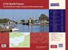
A new edition of the atlas North France, consisting of 6 double-sided sheets covering the coast from Nieuwpoort (Belgium) to Cherbourg.The atlas consists of the following:1. …