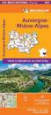
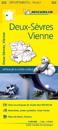
Michelin local maps are on a scale of 1:150,000 up 1:220,000 with easy to read mapping using satellite images. With additional tourist information, these maps are ideal for …
(Edition updated in 2019) The MICHELIN Calvados, Manche local map, scale 1/150,000 is the ideal companion to fully explore the coastal part of Normandy and provides star-rated …
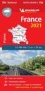
Updated annually, MICHELIN National Map France High Resistance will give you an overall picture of your journey thanks to its clear and accurate mapping scale 1:1 000 000 Our map …
Michelin's Road to liberty Map 105 covers the region associated with France's liberation between June 1944 and January 1945, at a scale of 1:500,000. This is a reprint of the 1947 …
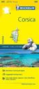
(Edition updated in 2018) The MICHELIN Corse-du-Sud, Haute-Corse local map, scale 1/150,000 is the ideal companion to fully explore Corsica and provides star-rated Michelin tourist …
Michelin National Map Series help you easily plan your safe and enjoyable journey thanks to a comprehensive key, a complete name index as well a clever timedistance chart. …