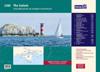
A convenient A2 format chart pack of The Solent and Isle of Wight provided in a sturdy plastic wallet. This fully revised and extended edition of our popular 2200 The Solent chart …
2400.1 Land's End to Trevose Head 1: 180 000 WGS 84 Includes plans Newquay Bay (1:10 000) and Saint Ives (1:15 000) 2400.2 Approaches to the Isles of Scilly 1: 120 000 WGS 84 …
On this 2017 edition the latest depth surveys have been applied, as has the latest information regarding wind farms and nature reserves. The chart specification has been improved …
On this the latest depth surveys have been applied. Harbour developments in Gibraltar are included as are the latest firing practice areas in Golfo de Cadiz. The chart …
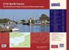
A new edition of the atlas North France, consisting of 6 double-sided sheets covering the coast from Nieuwpoort (Belgium) to Cherbourg.The atlas consists of the following:1. …
plastic wallet. Also available wiro-bound. Imray Digital Charts: Free mobile download A voucher code to download the relevant Imray digital charts into our Imray Navigator app is …
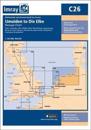
On this 2017 edition the latest depth surveys have been applied. The chart specification has been improved to show coloured light flashes. There has been general updating …