This seventh edition has been revised with new photos, updated technical and local information, and covers 60 miles of navigable waterways, including the tidal section to Kings …
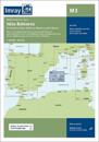
Plans included: San Antonio (Ibiza) (1:30 000) Puerto de Ibiza (Ibiza) (1:15 000) Puerto de Palma (Mallorca) (1:17 500) Porto Colom (Mallorca) (1:10 000) Puerto de Mahon (Menorca) …
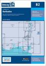
Caribbean Sea Plans included: Port St Charles & Port Ferdinand (sketch plan) Speightstown (1:15 000) Bridgetown (North) (1:20 000) Bridgetown (South) (1:20 000) On this 2018 …
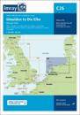
Successor to Henry Irving's long-established guide to the nooks and crannies of this fascinating corner of the east coast of England, this new title has extended coverage under the …
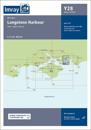
A brand new chart for 2022. The chart covers Langstone Harbour and its approaches. It includes the latest official UKHO data, combined with additional information sourced from …
This fully revised edition of our popular 3200 Islas Baleares chart pack consists of 25 sheets. It includes the latest official Instituto Hidrografico de la Marina data, combined …