karta, falsad., 2015, Engelska, ISBN 9781782570882
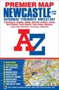
This A-Z Premier Map of Newcastle Upon Tyne is a full colour, single sided street map covering an area extending to:•Dinnington•Seaton Burn•Dudley (part)•Whitley …
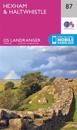
OS Explorer is the Ordnance Survey's most detailed map and is recommended for anyone enjoying outdoor activities like walking, horse riding and off-road cycling. The OS Explorer …
karta, falsad., 2020, Engelska, ISBN 9781839810312
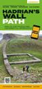
Hadrian's Wall Path Guidemap from Vertebrate Publishing is a lightweight, waterproof, durable and easy-to-use folding map with 1:40,000-scale mapping for the east to west HWP …
karta, falsad., 2020, Engelska, ISBN 9781912046584
Revised and updated version of our Road Map 3, based on Ordnance Survey 1/250000 data. Covering the south of Scotland from approximately Tobermory in the NW to just south of …
karta, falsad., 2023, Engelska, ISBN 9781851376681
Entire route on one map The Northumberland Coast Path stretches for 103km (64 miles) from Cresswell in the south to Berwick-upon-Tweed in the north, then the Berwickshire Coastal …
karta, falsad., 2019, Engelska, ISBN 9781851374380
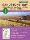
Toughdurable. XT40 - virtually indestructible. Light, compact. Entire route on one sheet. Clear easy to read. Sites of Roman remains. Accommodation and services. Great value for …