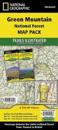
karta, falsad., 2012, Engelska, ISBN 9781566952996
Trails Illustrated topographic maps are the most detailed and up-to-date recreation maps available for these national parks, national forests and popular outdoor recreation areas. …
National Geographic Wall Maps offer a special glimpse into current and historical events, and they inform about the world and environment. Offered in a variety of styles and …
karta, falsad., 2012, Engelska, ISBN 9780792289890
National Geographic's Adventure Road Atlas is a rugged, 168-page road atlas that provides detailed maps of all 50 states, as well as Canada and Mexico. It features a tough, clear …
karta, falsad., 2015, Engelska, ISBN 9781597756006
Waterproof, tear-resistant topographic map. The Green Mountain National Forest Map Pack Bundle is the perfect companion to anyone planning a trip the stunning Green Mountains of …
karta, falsad., 2012, Engelska, ISBN 9781566953429
The Rocky Mountain National Park Trails Illustrated map is the most comprehensive recreational map for Colorado's Rocky Mountain National Park. Coverage includes Rocky Mountain …
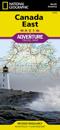
karta, falsad., 2013, Engelska, ISBN 9781566956376
National Geographic's Canada East Adventure Map is designed to meet the needs of adventure travelers with its durability and detailed, accurate information. The map includes the …
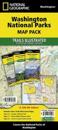
karta, falsad., 2015, Engelska, ISBN 9781597756020
Waterproof, Tear-Resistant Topographic Map. Washington is a state with diverse beauty, the Washington National Parks Map Pack bundle is a testament to this fact. Each of the three …
- Waterproof - Tear-Resistant - Topographic MapIn 1899, Mount Rainier became the fifth national park and the first to be established after the Forest Reserve Act of 1891 that …


![Glacier-Waterton Lakes Day Hikes & National Parks Maps [Map Pack Bundle]](https://s1.adlibris.com/images/65311364/glacier-waterton-lakes-day-hikes-national-parks-maps-map-pack-bundle.jpg)