An Atlas of Northamptonshire presents an historical atlas of the greater part of Northamptonshire (the first quarter having been published as An Atlas of Rockingham Forest). It …
This volume is an integrated overview and synthesis of available data relating to the Quaternary evolution of the River Trent. It provides detailed descriptions of the Pleistocene …
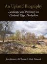
The Peak District is a historic upland landscape, with a rich palimpsest of features which invoke the many generations of people who have inhabited the area. The great estate of …
All Saints’ Church, Brixworth lies 7 miles north of Northampton. The core of the church is Anglo-Saxon and the research published here provides an unprecedented account of one of …
The excavations in the centre of Birmingham uncovered evidence of habitation from prehistoric and Roman times, but the 12th to 19th centuries presented by far the most evidence, …
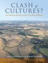
The general perception of the west midlands region in the Roman period is that it was a backwater compared to the militarized frontier zone of the north, or the south of Britain …
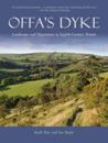
The massive ancient earthwork that provides the sole commemoration of an extraordinary Anglo-Saxon king and that gives its name to one of our most popular contemporary national …
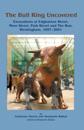
Gardom's Edge is an area of gritstone upland situated on the Eastern Moors of the Derbyshire Peak District. Like other parts of the Eastern Moors, Gardom's Edge has long been …
The Peak District is a historic upland landscape, with a rich palimpsest of features which invoke the many generations of people who have inhabited the area. The great estate of …
The West Midlands has struggled archaeologically to project a distinct regional identity, having largely been defined by reference to other areas with a stronger cultural identity …