Filter
- The history press ltd (2 881)
- Norstedts (2)
- Recito förlag (2)
- Bod (35)
- Trafik-nostalgiska förlaget (13)
- Dibb förlag (10)
- Balkong förlag (7)
- Kira förlag (4)
- Harpercollins publishers (123)
- Arcadia publishing library editions (7 041)
- Stockholmia förlag (4)
- Walab förlag (4)
- Bonnier fakta (1)
- Birlinn general (106)
- Bokförlaget kr (7)
- Globe bokhandel förlag (3)
- Bokförlaget korpen (3)
- Vulkan (28)
- Pretty city colouring (1)
- Folk tales (9)
- 1960-talets malmö (1)
- En liten bok om... (5)
- Skrifter utgivna av svenska litteratursällskapet i finland (3)
- Vadstena (2)
- Historic pub crawls (3)
- Foxfire series (3)
- In 50 buildings (126)
- Little history of (25)
- Skaftö sjöhistoria (1)
- Esbo stadsmuseums hembygdsserie (1)
- Images of america (247)
- Pubs (45)
- Curiosities series (2)
- Not a guide (23)
- True crime (37)
- Bloody british history (30)
Lokalhistoria
Filter
-

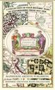
Oxfordshire 1611 - 1836 - Fold Up Map that features a collection of Four Historic Maps, John Speed's County Map 1611, Johan Blaeu's County Map of 1648, Thomas Moules County Map of 1836 and a Plan of Oxford 1836 by Thomas Moule. The maps also feature a number of Oxfords famous historic buildings.
av Mapseeker Publishing Ltd.