From the first vistas provided by flight in balloons in the eighteenth century to the most recent sensing operations performed by military drones, the history of aerial imagery has …
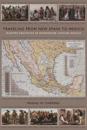
Antonio García Cubas’s Carta general of 1857, the first published map of the independent Mexican nation-state, represented the country’s geographic coordinates in precise detail. …