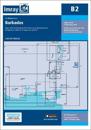
Caribbean Sea Plans included: Port St Charles & Port Ferdinand (sketch plan) Speightstown (1:15 000) Bridgetown (North) (1:20 000) Bridgetown (South) (1:20 000) On this 2018 …
karta, falsad., 2018, Engelska, ISBN 9783707916881
freytagberndt maps are available for many countries and regions in the world. In addition to the precise cartography each map also includes a lot of additional information about …
karta, falsad., 2019, Engelska, ISBN 9781786791467
On this edition the chart specification has been improved to show coloured light flashes. Depths have been updated from the latest available surveys where available. Completed …
karta, falsad., 2013, Engelska, ISBN 9782067185494
(Edition updated in 2018), MICHELIN National Map Cuba will give you an overall picture of your journey thanks to its clear and accurate mapping scale 1/800,000. Our National Map …
Plans included: Rodney Bay and Yacht Harbour (1:25 000) Port Castries (1:12 500) Grand Cul de Sac Bay (1:15 000) Marigot Harbour (1:7500) Soufriere Bay and The Pitons (1:40 000) …