Filter
  • Imray Chart B2

    av

    karta, falsad., 2018, ISBN 9781786790187

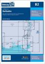
    Caribbean Sea Plans included: Port St Charles & Port Ferdinand (sketch plan) Speightstown (1:15 000) Bridgetown (North) (1:20 000) Bridgetown (South) (1:20 000) On this 2018

  • Imray Chart A233

    karta, falsad., 2023, ISBN 9781786795151

    Plans included: Charlotte Amalie (St Thomas) (1:30 000) Cruz Bay (St John) (1:20 000) Road Harbour, Sea Cow Bay & Nanny Cay Marina (Tortola) (1:20 000) Benner Bay (St Thomas) (1:30

  • Imray Chart A2

    karta, falsad., 2023, ISBN 9781786795137

    Imray-Iolaire charts for the Caribbean are widely acknowledged as the best available for the cruising sailor. They combine the latest official survey data with first-hand

  • Imray Chart B1

    karta, falsad., 2021, ISBN 9781786793119

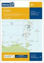
    Plans included: Rodney Bay and Yacht Harbour (1:25 000) Port Castries (1:12 500) Grand Cul de Sac Bay (1:15 000) Marigot Harbour (1:7500) Soufriere Bay and The Pitons (1:40 000)

  • Imray Chart A232

    karta, falsad., 2023, ISBN 9781786795182

    Plans included: Road Harbour & Approaches (Tortola) (1:20 000) Virgin Gorda Yacht Harbour (Virgin Gorda) (1:20 000) South Sound (Virgin Gorda) (1:20 000) Gorda Sound (Virgin Gorda)

  • Imray Chart A231

    av

    karta, falsad., 2019, ISBN 9781786791566

    Plans included: Charlotte Amalie (St Thomas) (1:30,000) Cruz Bay (St John) (1:20,000) Road Harbour, Sea Cow Bay & Nanny Cay Marina (Tortola) (1:20,000) Benner Bay (St Thomas)

  • Imray Chart A231

    karta, falsad., 2023, ISBN 9781786795144

    Imray-Iolaire charts for the Caribbean are widely acknowledged as the best available for the cruising sailor. They combine the latest official survey data with first-hand