karta, falsad., 2023, Engelska, ISBN 9780008579999
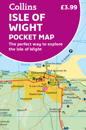
Explore new places with handy pocket maps from Collins. Handy little full-colour map of the Isle of Wight. Detailed mapping and tourist information of the whole island. …
First in a new series of cycle maps covering the whole country. The maps are all produced at a scale of 1:100 000 showing important features including the National cycle Network. …
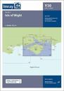
This edition includes the latest official UKHO data, combined with additional information sourced from Imray's network to make it ideal for small craft. The latest racing buoy …
OS Explorer is the Ordnance Survey's most detailed map and is recommended for anyone enjoying outdoor activities like walking, horse riding and off-road cycling. Providing complete …
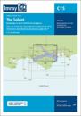
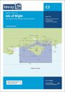
Coverage has been adjusted to show the full circumnavigation of the Isle of Wight including the south coast passage. Inset plans of the Needles Channel and Bembridge Harbour and …