Filter
- Trafik-nostalgiska förlaget (1)
- Harpercollins publishers (18)
- Dorling kindersley ltd (9)
- Lind co (1)
- Taschen gmbh (5)
- Dk (3)
- Thameshudson ltd (1)
- Quarto publishing plc (5)
- Bloomsbury publishing plc (3)
- Granta books (3)
- Workman publishing (1)
- Batsford (2)
- The historic towns trust (16)
- White star (3)
- Scholastic (4)
- Historical images ltd (37)
- Waverley books (2)
- Bokförlaget stolpe (2)
- Dk history map by map (4)
- Unexpected atlases (1)
- Atlases of the imagination (2)
- Horrible histories (2)
- Town & city historical maps series (3)
- Atlas series (4)
- Atlas (5)
- Historical map (1)
- Routledge historical atlases (5)
- Brill research perspectives in map history (8)
- Historic counties maps collection (7)
- Old ordnance survey maps of yorkshire (7)
- Creating the north american landscape (5)
- Irish historic towns atlas (4)
- Armchair time travellers stree (3)
- Maps, spaces, cultures (3)
- Old ordnance survey maps of lancashire (3)
- Old ordnance survey maps of warwickshire (3)
Historiska kartor & atlaser
Filter
-

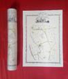
Hampshire 1610 – 1836 – Fold Up Map that features a collection of Four Historic Maps, John Speed’s County Map 1611, Johan Blaeu’s County Map of 1648, Thomas Moules County Map of 1836 and a Plan of Winchester 1805 by Cole and Roper. The maps also feature three historic views from the 1840’s, Gosport, Men of War at Spithead and The Saluting Platform at Portsmouth.
av Mapseeker Publishing Ltd.