Filter
- The history press ltd (73)
- Oxford university press (2)
- The borough press (1)
- Mills boon (1)
- Elliott thompson limited (2)
- Collins (1)
- Harpercollins publishers (34)
- Cornerstone (2)
- Icon books ltd (1)
- Vertical editions (1)
- Apa publications (3)
- Penguin books ltd (7)
- Amberley publishing (84)
- Ordnance survey (12)
- Archaeopress (12)
- Oxbow books (9)
- Pen sword books (7)
- Imray, laurie, norie wilson ltd (9)
- Girl meets duke (1)
- Literary christmas (1)
- Oxford world's classics (1)
- Rough guides main series (1)
- Winchester studies (10)
- Through time (8)
- A tudor mystery featuring ursula blanchard (4)
- Os explorer map (6)
- Images of (4)
- Photographic memories (4)
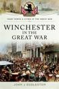
- Your towns & cities in the great war (4)
- A hildegard of meaux medieval mystery (2)
- Applemore bay (3)
- Josephine fox mysteries (3)
- Os explorer map active (3)
- Secret (3)
- A potted history (2)
- Archaeological histories (1)
Hampshire
Filter
-

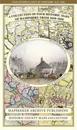
Hampshire 1610 – 1836 – Fold Up Map that features a collection of Four Historic Maps, John Speed’s County Map 1611, Johan Blaeu’s County Map of 1648, Thomas Moules County Map of 1836 and a Plan of Winchester 1805 by Cole and Roper. The maps also feature three historic views from the 1840’s, Gosport, Men of War at Spithead and The Saluting Platform at Portsmouth.
av Mapseeker Publishing Ltd.