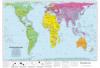
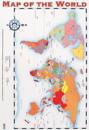
This accurate, colour-coded map shows all areas according to their actual size, with the North-South lines running vertically and the East-West lines running parallel.
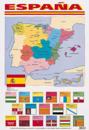
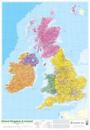
This colourful map shows the borders of each Spanish region, and indicates the location of islands and major cities. A separate map illustrates the positions of the Canary Islands, …
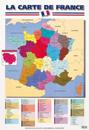
This colourful map shows the borders of each French region, and the separate districts within them. The location of major cities is also indicated, and a separate map illustrates …
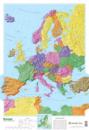
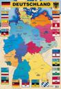
This colourful map shows the borders of each German state, and indicates the location of rivers and major cities. Around the map, separate images show the flag, symbol, capital …
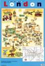
This useful poster features a map of central London with illustrations of significant tourist attractions, such as Marble Arch, the Natural History Museum and London Zoo. A map of …