This title is a vivid description of one of the most ambitious scientific projects undertaken in the 19th century - the measurement of the Himalayas and the mapping of the Indian …
Navigate your way around Portsmouth with this detailed and easy-to-use A-Z Street Atlas. Printed in full-colour, paperback format, this atlas contains 54 pages of …
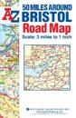
This A-Z 50 Miles around Bristol map is a full colour, single sided, fold-out road map featuring continuous mapping extending to include Worcester and Stratford-upon-Avon to the …
This up-to-date detailed A-Z street map includes more than 3,000 streets in and around Birmingham. As well as the city centre and St Philip’s Cathedral, the other areas …
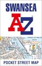
This up-to-date detailed A-Z street map includes more than 1,500 streets in and around Swansea. As well as the city centre and Swansea Maritime Quarter, the other areas …
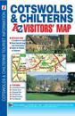
This map of the Cotswolds & Chilterns is a full colour visitors' map featuring road mapping that covers an area extending to:•Worcester•Royal Leamington …
This up-to-date detailed A-Z street map includes more than 2,000 streets in and around Portsmouth. As well as ferry routes from Portsmouth Harbour, other areas covered …
This up-to-date detailed A-Z street map includes more than 2,000 streets in and around Leicester. As well as the city centre and Leicester Cathedral, the other areas …
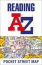
This up-to-date detailed A-Z street map includes more than 1,500 streets in and around Reading. As well as the city centre and the University of Reading, the other areas …
Navigate your way around Southampton with this detailed and easy-to-use A-Z Street Atlas. Printed in full-colour, paperback format, this atlas contains 50 pages of …