Bedrock ('Solid') geology map of the British Islands, covering England, Wales, Scotland and the Scottish Islands, The Isle of Man, Northern Ireland and Ireland.
The World Distribution of Thorium Deposits map, at a scale of 1:35 000 000, is intended to be a snapshot of the IAEA ThDEPO database showing the broad distribution of thorium …
plastic wallet. Also available wiro-bound. Imray Digital Charts: Free mobile download A voucher code to download the relevant Imray digital charts into our Imray Navigator app is …
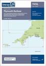
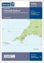
Plans included:Mylor Yacht Harbour (1:10 000)Falmouth Marina (1:5000)Falmouth Inner Harbour (1:10 000)First edition. Part of the small format Y series (A2 size), this replicates …
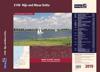
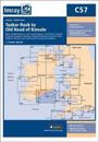
On this 2017 edition the latest depth surveys have been applied. The chart specification has been improved to show coloured light flashes. There has been general updating …
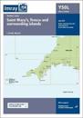
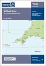
Plans included:Continuation of Helford River to Gweek (1:17 000)First edition. Part of the small format Y series (A2 size), this replicates sheet 2400.11 from the 2400 West Country …