Spatial Thinking in Environmental Contexts: Maps, Archives, and Timelines cultivates the spatial thinking "habit of mind" as a critical geographical view of how the world works, …
Uncertainty and context pose fundamental challenges in GIScience and geographic research. Geospatial data are imbued with errors (e.g., measurement and sampling) and various types …
The demand on local government to do more with less by improving operations, increasing productivity, and making better and more informed decisions increases constantly. On a …
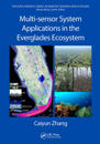
This book explores the applicability of multiple remote sensors to acquire information relevant to restoration and conservation efforts in wetlands using data collected from …
Fundamentals of Satellite Remote Sensing: An Environmental Approach, Third Edition, is a definitive guide to remote sensing systems that focuses on satellite-based remote sensing …
This book explores how we create deep maps, delving into the development of methods and approaches that move beyond standard two-dimensional cartography.Deep mapping offers a more …
This book provides a step-by-step guide on how to use various publicly available remotely sensed time series data sources for environmental monitoring and assessment. Readers will …
This lab manual is a companion to the second edition of the textbook Real-Time Environmental Monitoring: Sensors and Systems. Tested in pedagogical settings by the author for many …
This book covers the state-of-art image classification methods for discrimination of earth objects from remote sensing satellite data with an emphasis on fuzzy machine learning and …
This book is based on the authors’ extensive involvement in Synthetic Aperture Radar (SAR) mapping projects, targeting the health of an earth ecosystem with great relevance for …