Filter
- Lind co (1)
- Harpercollins publishers (20)
- Antiikki-kirja (1)
- Dorling kindersley ltd (9)
- John nurmisen säätiö (2)
- Michelin editions des voyages (1)
- National geographic society (2)
- Dk (3)
- Atlasart (4)
- Batsford (2)
- Workman publishing (1)
- Standards manual (1)
- Alan godfrey maps (54)
- Historical images ltd (37)
- Brill (35)
- Taylor francis (12)
- Mapseeker digital ltd (21)
- Bloomsbury publishing (10)
- Dk history map by map (4)
- Atlases of the imagination (2)
- Routledge historical atlases (5)
- Old ordnance survey maps of yorkshire (8)
- Brill research perspectives in map history (8)
- Historic counties maps collection (7)
- Atlas (5)
- Creating the north american landscape (5)
- Old ordnance survey maps of lancashire (5)
- Atlas series (4)
- Irish historic towns atlas (4)
- Armchair time travellers stree (3)
- Maps, spaces, cultures (3)
- Old ordnance survey maps of warwickshire (3)
- Town & city historical maps series (3)
- Armchair time travellers railw (2)
- Early modern literary geographies (2)
- Elements in digital literary studies (1)
Historiska kartor & atlaser
Filter
-
-

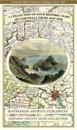
Cornwall 1611 – 1836 – Fold Up Map that features a collection of Four Historic Maps, John Speed’s County Map 1611, Johan Blaeu’s County Map of 1648, Thomas Moules County Map of 1836 and Robert Dawson’s Reform Act Plan of Truro 1831. The maps are surrounded by Cornwall’s Historic Buildings.
av Mapseeker Publishing Ltd.