Hakutulokset: mapping north america
Etsimme kuitenkin kirjoja hakusanalla Mapping North America , mikä antoiyhteensä 24 hakutulosta

History of North America Map by Map
A visual journey through the history of North America via a series of engaging, detailed maps, explaining key events and eras from prehistory to the 21st century. Specially created …

National Geographic North America Map (Folded with Flags and Facts)
Waterproof Tear-Resistant Reference Map. Expertly researched and designed, National Geographic's North America Flags and Facts Map is the authoritative map of North America by …

A Topographical Description Of The Dominions Of The United States Of America. (Being A Rev. And Enl. Ed. Of) A Topographical Description Of Such Parts Of North America As Are Contained In The (Annexed) Map Of The Middle British Colonies, &C., In North Americ
A Topographical Description Of The Dominions Of The United States Of America. (Being A Rev. And Enl. Ed. Of) A Topographical Description Of Such Parts Of North America As Are …

Hacemos mapas de Norteamérica (Mapping North America)
Including the Great Plains of the United States and the huge icebergs of Greenland, North America is a continent with a wide range of geography, climate, and cultures. Colorful …

The Discovery of North America; A Critical, Documentary, and Historic Investigation, with an Essay on the Early Cartography of the New World, Including Descriptions of Two Hundred and Fifty Maps or Globes Existing or Lost, Constructed Before the Year 1536
This book has been considered by academicians and scholars of great significance and value to literature. This forms a part of the knowledge base for future generations. So that …

Catalogue of books and pamphlets, atlases, maps, plates, and autographes relating to North and South America
This book has been considered by academicians and scholars of great significance and value to literature. This forms a part of the knowledge base for future generations. So that …

North America Map, Pleated Physical/Political 1:8 000 000
freytagberndt maps are available for many countries and regions in the world. In addition to the precise cartography each map also includes a lot of additional information about …

A Topographical Description of the Dominions of the United States of America. a Topographical Description of Such Parts of North America as Are Contained in the (Annexed) Map of the Middle British Colonies, &c., in North AME
This work has been selected by scholars as being culturally important, and is part of the knowledge base of civilization as we know it. This work was reproduced from the original …
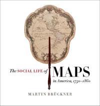
The Social Life of Maps in America, 1750-1860
In the age of MapQuest and GPS, we take cartographic literacy for granted. We should not; the ability to find meaning in maps is the fruit of a long process of exposure and …

Social Life of Maps in America, 1750-1860
In the age of MapQuest and GPS, we take cartographic literacy for granted. We should not; the ability to find meaning in maps is the fruit of a long process of exposure and …