Sökt på: Imray
totalt 344 träffar

Imray Chart C20
A passage chart designed for planning and navigating across the North Atlantic between Gibraltar, the Azores and the Canary Islands.

The Cruising Almanac Tide Tables 2024
Available separately from the Cruising Almanac 2024, the 2024 tide tables now include tide times for Zeebrugge Corrections and updates are issued monthly (approximately) and are …
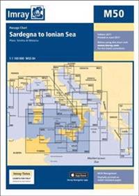
Imray Chart M50
Plans included:Stretto di Messina (1:125 000)On this 2017 edition the two new Traffic Separation Schemes off the Algerian coast are shown. The chart specification has been improved …

Imray Chart M40
Plans included: Monte Argentario (1:100 000) Bonifacio Strait (1:225 000) Golfo di Salerno (1:100 000) For this 2014 edition the chart has been fully updated throughout using …

Imray Chart M23 Adriatic Sea Passage Chart
On this edition the chart specification has been improved to show coloured light flashes. The latest information on marine reserves and their extents have been included. The …

Imray Chart B1
Plans included: Rodney Bay and Yacht Harbour (1:25 000) Port Castries (1:12 500) Grand Cul de Sac Bay (1:15 000) Marigot Harbour (1:7500) Soufriere Bay and The Pitons (1:40 000) …

Imray Chart B5
On this 2018 edition the chart specification has been improved to show coloured light flashes. There has been general updating throughout.

Imray Chart Y12 Laminated
Plans included: Upper Orwell to Ipswich (1:20 000) Fox's Marina (1:10 000) Woolverstone Marina (1:10 000) Suffolk Yacht Harbour (1:10 000) Shotley Marina (1:10 000). For this 2022 …

North Sea Passage Pilot
Readers of Imray's East Coast Pilot will need no introduction to Garth Cooper whose familiarity with North Sea passage-making is evident in the practical guidance he gives.

Imray Chart C26
Plans included: Plans included: IJmuiden (1:35 000) Den Helder (1:21 000) West-Terschelling (1:20 000) Lauwersoog (1:15 000) Borkum Yacht Harbour (1:25 000) Norderney Approaches …

C70 Southern North Sea Passage Chart
On this edition the chart specification has been improved to show coloured light flashes.

Imray Chart C38
Plans included: Port la Foret (1:15 000) Concarneau (1:15 000) Port Manec'h (1:35 000) Ports BrigneauMerrien (1:20 000) Doelan (1:15 000) Iles de Glenan North (1:30 000) Lorient …