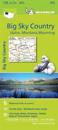
karta, falsad., 2014, Engelska, ISBN 9782067190801
Michelin's Zoom collection are characterized by the high precision of their detailed scale, specially adapted for very touristy areas or with a high density road network, including …
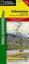
karta, falsad., 2012, Engelska, ISBN 9781566952958
Trails Illustrated topographic maps are the most detailed and up-to-date recreation maps available for these national parks, national forests and popular outdoor recreation areas. …
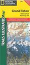
karta, falsad., 2013, Engelska, ISBN 9781566954372
This Trails Illustrated topographic map is the most comprehensive recreational map for Wyoming's Grand Teton National Park. Coverage includes Fort Meade Recreation Area, Black …