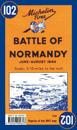
Michelin Battle of Normandy Map 102 covers the region associated with the Battle of Normandy between June and August 1944, at a scale of 1:200,000. Historic WWII reproduction map. …
In French and in English, one side shows the position of the different armies and the progression of the Battle of Normandy. The other side features a photograph which shows the …
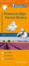
(Edition updated in 2016) MICHELIN Provence-Alps-French Riviera Regional Map scale 1/200,000 will provide you with an extensive coverage of primary, secondary and scenic routes for …
(Edition updated in 2018) The MICHELIN Alpes-de-Haute-Provence, Hautes-Alpes local map, scale 1/150,000 is the ideal companion to fully explore the French alps and provides …
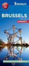
Discover Brussels by foot, car or bike using Michelin Brussels City Plan (scale 1/15,000 cm). In addition to Michelin's clear and accurate mapping, this city plan will help you …
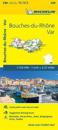
(Edition updated in 2018) The MICHELIN Bouches-du-Rhone, Var local map, scale 1 /150,000 is the ideal companion to fully explore southern France and provides star-rated Michelin …
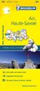
Michelin local maps are on a scale of 1:150,000 up 1:220,000 with easy to read mapping using satellite images. With additional tourist information, these maps are ideal for …
Insight Guides Flexi Map Amsterdam:This easy to use, full-colour, water-proof map is all you need to navigate Amsterdam. It also includes handy destination detail on Amsterdam …