Vägkartor & -atlaser

Filter
  • Imray Chart C9

    karta, falsad., 2024, ISBN 9781786795601

    1:120 000 WGS 84 Plans included: Eastern Approaches to the Solent (1:60 000) Littlehampton (1:13 500) Shoreham Harbour (1:20 000) Brighton Marina (1:8500) Newhaven (1:16 500)

  • Imray Chart C2

    karta, falsad., 2024, ISBN 9781786795663

    1: various WGS 84 A navigation chart of the River Thames from Teddington to Southend in four panels: Southend to Barking Creek (1:42 500) Barking Creek to Vauxhall Bridge (1:17

  • Imray Chart C8

    karta, falsad., 2024, ISBN 9781786795595

    1:120 000 WGS 84 Plans included: Sovereign Harbour (1:20 000) Rye Harbour (1:35 000) Folkestone Harbour (1:10 000) Dover (1:15 000) River Stour Entrance (1:35 000) Ramsgate

  • Imray Chart C3

    karta, falsad., 2024, ISBN 9781786795670

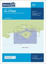
    Coverage has been adjusted to show the full circumnavigation of the Isle of Wight including the south coast passage. Inset plans of the Needles Channel and Bembridge Harbour and