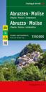
karta, falsad., 2022, Engelska, ISBN 9783707921212
In addition to the clear design, the road and leisure map Abruzzo - Molise offers a lot of additional information such as sights, campsites and various city center maps. The …
karta, falsad., 2018, Engelska, ISBN 9783707917598
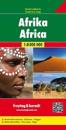
freytagberndt maps are available for many countries and regions in the world. In addition to the precise cartography each map also includes a lot of additional information about …
karta, falsad., 2009, Engelska, ISBN 9783707906295
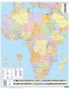
freytagberndt maps are available for many countries and regions in the world. In addition to the precise cartography each map also includes a lot of additional information about …
karta, falsad., 2017, Engelska, ISBN 9783899203240
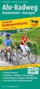
The leporello-style map presents the 77 km long Ahr cycle path, which follows the course of the Ahr from its source to where it flows into the Rhine near Remagen.
karta, falsad., 2017, Engelska, ISBN 9783899207569
Från 176 kr
For many, the Aischtal Cycle Path is one of the most beautiful river cycle paths in Germany. The cycle path, awarded 4 stars by the ADFC as a quality route in 2013, combines Middle …
karta, falsad., 2022, Engelska, ISBN 9783707921816
In addition to the clear design, the Alaska double-sided folded road map at a scale of 1:1,500,000 offers a lot of additional information such as sights, national parks and a …
karta, falsad., 2023, Engelska, ISBN 9783707921960
In addition to the clear design, the road map "Albania 1:400,000" offers a lot of additional information such as road conditions, sights and campsites.
karta, falsad., 2018, Engelska, ISBN 9783899202199
Water is the defining element of the hike on the Albsteig: The 83 km long hiking trail accompanies the southern Black Forest Alb from its confluence with the Rhine near Albbruck to …