"The detail you need at a size you can read". The latest 2024 Big Easy to Read Britain road atlas from Philip's with: - Large print maps - Huge 1:150,000 scale (approx 2.4 miles to …
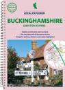
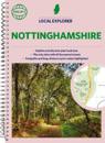
Who hasn't explored and enjoyed their surrounding area in recent years and come to appreciate what is on our respective doorsteps? Philip's have created this new series for …
Coming from the market leader in European mapping, this compact spiral edition gives more to leisure travellers with its unique factfinder of key statistics, currency, driving regs …
No. 1 in the UK for clear maps Philip's bring you the latest large spiral-bound format Big Road Atlas Britain and Ireland 2024 with fully updated maps from the Philip's digital …
The only county Street Atlas with all the named streets of Suffolk and perfect back-up for emergency services, delivery drivers, visitors and locals.With more than 13,000 named …
Philip's created this new series for walkers, cyclists and local explorers at a scale that provides greener options to uncover all the nature and hidden gems in your local area. …
Philip's created this new series for walkers, cyclists and local explorers at a scale that provides greener options to uncover all the nature and hidden gems in your local area. …
THE ONLY COUNTY STREET ATLAS WITH ALL THE NAMED STREETS OF DERBYSHIRE.The UK's best-selling county street atlasesMore than 24,000 named streets, roads, lanes and alleysThe …
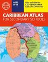
A new edition of the market-leading atlas for CXC Geography students, Philip's Caribbean Atlas for Secondary Schools provides extensive coverage of the Caribbean area, together …
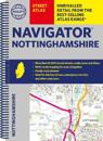
The only county Street Atlas with all the named streets of Nottinghamshire and perfect back-up for emergency services, delivery drivers, visitors and locals.With more than 18,000 …