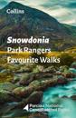
Walking guide to the Snowdonia National Park, with 20 best routes chosen by the park rangers. Each walk varies in length from 2 to 10 km and can be completed in less than 4 hours. …
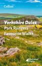
Walking guide to the Yorkshire Dales National Park, with 20 best routes chosen by the park rangers. Each walk varies in length from 2 to 10 km and can be completed in less than 4 …
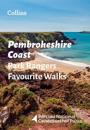
The perfect companions for exploring the National Parks. Walking guide to the Pembrokeshire Coast National Park, with 20 best routes chosen by the park rangers. Each walk …
Walking guide to the Peak District National Park, with 20 best routes chosen by the park rangers. Each walk varies in length from 2 to 10 km and can be completed in less than 4 …
Build your child’s reading confidence at home with books at the right level Follow Kwame Nkrumah-Acheampong's amazing life from a small town in Ghana to the slopes of the …
A definitive guide to the streets of London. The ultimate Collins street atlas of London, featuring incredibly detailed street level maps, with more than 40 categories of …
Build your child’s reading confidence at home with books at the right level It’s just a normal lesson on a normal day at school, except Mrs Bennet , who can do magic, has …
Walking guide to the South Downs National Park, with 20 best routes chosen by the park rangers. Each walk varies in length from 2 to 10 km and can be completed in less than 4 …
A beautifully presented gift for anyone with an intrigue for geographical curiosities. This beautifully designed book presents unusual borders, enclaves and exclaves, …