karta, falsad., 2023, Engelska, ISBN 9780008580056
Explore new places with handy pocket maps from Collins. Handy little full-colour map of the Western Isles of Scotland. Detailed mapping and tourist information for the …
karta, falsad., 2023, Engelska, ISBN 9780008580001
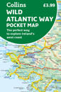
Explore new places with handy pocket maps from Collins. Handy full-colour map of Ireland’s Wild Atlantic Way with a high level of detail. Clear mapping of the full 2500 …
karta, falsad., 2023, Engelska, ISBN 9780008607104
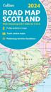
Full-colour map of Scotland at 8.7 miles to 1 inch, with clear road network and administrative areas shown in colour. The map covers the whole of Scotland and part of Northern …
karta, falsad., 2023, Engelska, ISBN 9780008581794
Clear and easy-to-read map of central London and surrounding area. Contains detailed mapping, presented in a handy compact format. This attractive map, ideal for both tourists and …
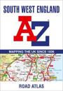
This full-colour road atlas features 30 pages of continuous road mapping. Includes Cornwall, Devon, Dorset, Plymouth Somerset and Torbay. Published at a clear 2.5 miles …
karta, falsad., 2023, Engelska, ISBN 9780008581763
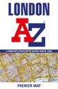
Navigate your way around London with this detailed, easy-to-use, and up-to-date A-Z Premier Map. A full-colour, single sided, fold-out street map, covering a six-mile …
A pocket-sized, paperback street atlas of Central London and the surrounding areas in full colour. Covering an area extending from the centre of London to: Brent Cross, …
karta, falsad., 2023, Engelska, ISBN 9780008581787
This great value, fold-out map uses our instantly recognisable A-Z street mapping and has handy a TfL Tube map on the back for easy access. Published at a scale of 3.5 …
karta, falsad., 2023, Engelska, ISBN 9780008579999
Explore new places with handy pocket maps from Collins. Handy little full-colour map of the Isle of Wight. Detailed mapping and tourist information of the whole island. …
Full-colour road atlas of Wales, with extended coverage into England and including all the major routes into the country. The detailed road mapping also includes Liverpool, …