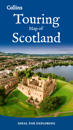
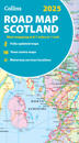
karta, falsad., 2024, Engelska, ISBN 9780008665012
Explore new places with this up-to-date map of Scotland. Best-selling map of Scotland. More than 1,000 places of tourist interest plotted and named on the map. The …
karta, falsad., 2024, Engelska, ISBN 9780008653118
Explore the whole county and area extending into Devon as far as Great Torrington, Tavistock and Plymouth. This detailed and up-to-date map contains more than 1,000 places of …
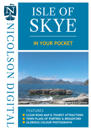
karta, falsad., 2024, Engelska, ISBN 9781912046768
The Isle of Skye In Your Pocket is our new essential map for visiting Skye. The front has exceptionally clear road mapping of the whole island showing main tourist attractions, EV …
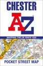
karta, falsad., 2024, Engelska, ISBN 9780008657451
Navigate your way around Chester with detailed street maps from A-Z This up-to-date, folded A-Z street map includes 2,600 streets in and around Brighton. As well as the …
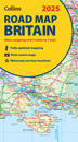
karta, falsad., 2024, Engelska, ISBN 9780008652913
Explore Britain with easy-to-read mapping from Collins. Full-colour, double-sided road map of Great Britain at a scale of 8.7 miles to 1 inch. Northern England, Scotland …
karta, falsad., 2024, Engelska, ISBN 9780008652999
Explore Scotland with easy-to-read mapping from Collins. Full-colour map of Scotland at 8.7 miles to 1 inch, with clear road network and administrative areas shown in …
karta, falsad., 2024, Engelska, ISBN 9780749584078
Fully updated, the maps combine clear design and an easy-to-read scale with more road detail to ensure that you never lose your way. Each map includes information on toll points, …
karta, falsad., 2024, Engelska, ISBN 9780008653125
Explore the whole region and area extending from Cockermouth and Penrith in the north to Ulverston and Grange-over-Sands in the south and from the M6 in the east to the coast in …
karta, falsad., 2024, Engelska, ISBN 9780749584085
Fully updated, the maps combine clear design and an easy-to-read scale with more road detail to ensure that you never lose your way. Each map includes information on toll points, …