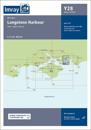
A brand new chart for 2022. The chart covers Langstone Harbour and its approaches. It includes the latest official UKHO data, combined with additional information sourced from …
karta, falsad., 2016, Engelska, ISBN 9781846238635
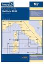
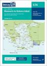
Plans included: La Maddalena (1:10 000) On this 2016 edition the latest depth surveys have been applied where available. The latest nature reserve information is included and the …
karta, falsad., 2020, Engelska, ISBN 9781786792020
On this edition the chart specification has been improved to show coloured light flashes. The latest information on marine reserves and their extents have been included. The …
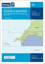
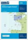
Coverage on this chart allows for passage planning in the Western English Channel, from Isles of Scilly to the Isle of Wight, and from Ile d'Ouessant to Cherbourg. The latest …
karta, falsad., 2019, Engelska, ISBN 9781786791450
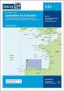
On this edition the chart specification has been improved to show coloured light flashes. A new plan is included of Aviles showing the approach to Aviles and navigation to the …
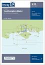
This chart is a replica of Imray chart 2200.11 covering Southampton Water. This edition includes the latest official UKHO data, combined with additional information sourced from …
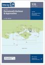
This chart has been reschemed to provide coverage of Portsmouth Harbour and its approaches at a better scale. The product now consists of a package of two charts, replicas of Imray …