Filter
Segling
Filter
1:120 000 WGS 84 Plans included: Eastern Approaches to the Solent (1:60 000) Littlehampton (1:13 500) Shoreham Harbour (1:20 000) Brighton Marina (1:8500) Newhaven (1:16 500) …
Plans included: Plans included: IJmuiden (1:35 000) Den Helder (1:21 000) West-Terschelling (1:20 000) Lauwersoog (1:15 000) Borkum Yacht Harbour (1:25 000) Norderney Approaches …
Plans included: Salcombe (1:15 000) Plymouth Sound (1:50 000) Looe (1:5000) Polperro Harbour (1:3500) Fowey Harbour and Approaches (1:10 000) Charlestown Harbour (1:5000) …
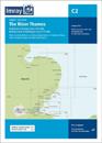
1: various WGS 84 A navigation chart of the River Thames from Teddington to Southend in four panels: Southend to Barking Creek (1:42 500) Barking Creek to Vauxhall Bridge (1:17 …
This edition includes the latest official UKHO data, combined with additional information sourced from Imray's network to make it ideal for small craft. The chart has been fully …
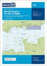
Coverage on this chart allows for passage planning in the Western English Channel, from Isles of Scilly to the Isle of Wight, and from Ile d'Ouessant to Cherbourg. The latest …
Plans included: Oudeschild (1:15 000) Den Helder (1:21 000) IJmuiden (1:35 000) Scheveningen (1:10 000)
Carnlough Harbour (sketch plan) Larne (1:18 500) Carrickfergus (1:15 000) Bangor Bay (1:17 500) Donaghadee Sound (1:25 000) Entrance to Strangford Lough (1:37 500) Portaferry …
This edition includes the latest official data combined with additional information sourced from Imray's network to make it ideal for small craft. It includes the latest official …
Plans included: Alderney Harbour (1:9000) Beaucette Marina (1:15 000) St Sampson Hbr (1:20 000) St Peter Port (1:10 000) Creux Harbour Approaches (1:25 000) Gorey (1:20 000) …