This fully revised edition of our popular 3200 Islas Baleares chart pack consists of 25 sheets. It includes the latest official Instituto Hidrografico de la Marina data, combined …
plastic wallet. Also available wiro-bound. Imray Digital Charts: Free mobile download A voucher code to download the relevant Imray digital charts into our Imray Navigator app is …
2600.1 Trevose Head to St David's Head 1:450, 000 WGS 84 2600.2 Padstow to Hartland Point 1:120, 000 WGS 84 Plans Approaches to Padstow, Bude Haven 2600.3 Hartland to Ilfracombe …
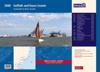
This fully revised and extended edition of our popular 2000 Suffolk and Essex Coasts chart pack has been redesigned and expanded to 11 sheets, including improved coverage of …
2400.1 Land's End to Trevose Head 1: 180 000 WGS 84 Includes plans Newquay Bay (1:10 000) and Saint Ives (1:15 000) 2400.2 Approaches to the Isles of Scilly 1: 120 000 WGS 84 …
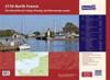
A new edition of the atlas North France, consisting of 6 double-sided sheets covering the coast from Nieuwpoort (Belgium) to Cherbourg.The atlas consists of the following:1. …
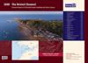
This fully revised and extended edition includes the latest official UKHO data combined with additional information sourced from Imray's network to make it ideal for small craft. …
This fully revised edition of our popular 3200 Islas Baleares chart pack consists of 25 sheets. It includes the latest official Instituto Hidrografico de la Marina data, combined …
The atlas contains 12 sheets- 2600.1 Trevose Head to St David's Head 1:450, 000 WGS 84 2600.2 Padstow to Hartland Point 1:120, 000 WGS 84 Plans Approaches to Padstow, Bude Haven …
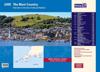
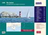
A convenient A2 format chart pack of The Solent and Isle of Wight provided in a sturdy plastic wallet. This fully revised and extended edition of our popular 2200 The Solent chart …