Double -sided. Side one- Europe from Ireland and Portugal to the Caspian Sea - dimensions 1210 x 870 mm. Scale 1:4 000 000- enlargement on reverse, with unprecedented detail, …
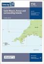
1:120 000 WGS 84 This edition includes the latest official UKHO data, combined with additional information sourced from Imray's network to make it ideal for small craft. It …
Plans included: San Antonio (Ibiza) (1:30 000) Puerto de Ibiza (Ibiza) (1:15 000) Puerto de Palma (Mallorca) (1:17 500) Porto Colom (Mallorca) (1:10 000) Puerto de Mahon (Menorca) …
karta, falsad., 2020, Engelska, ISBN 9781786791887
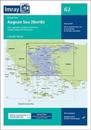
On this edition the chart specification has been improved to show coloured light flashes. Completed harbour works are included on the plan of the approaches to Istanbul. There has …
karta, falsad., 2021, Engelska, ISBN 9781786792532
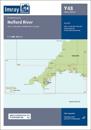
This popular map of the non-tidal Thames from its the source above Cricklade to the entrance of the Grand Union Canal at Brentford below Teddington Locks is convenient in any …
Caribbean Sea Plans included: Port St Charles & Port Ferdinand (sketch plan) Speightstown (1:15 000) Bridgetown (North) (1:20 000) Bridgetown (South) (1:20 000) On this 2018 …