Double -sided. Side one- Europe from Ireland and Portugal to the Caspian Sea - dimensions 1210 x 870 mm. Scale 1:4 000 000- enlargement on reverse, with unprecedented detail, …
karta, falsad., 2018, Engelska, ISBN 9781786790477
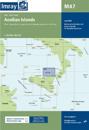
Plans included:Ayvalik (1:75 000)Sigri (N. Lesvos) (1:30 000)Entrance to Kolpos Kalloni (N. Lesvos) (1:30 000)Entrance to Kolpos Yeras (N. Lesvos) (1:40 000)Mitilini (N. Lesvos) …
karta, falsad., 2018, Engelska, ISBN 9781786790224
Plans included:Approaches to Lipari (1:25 000)Bocche di Vulcano (1:45 000)Approaches to Milazzo (1:30 000)On this 2018 edition a new plan showing the approaches to Milazzo is …
karta, falsad., 2020, Engelska, ISBN 9781786791955
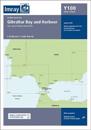
A brand new chart for 2020 covering Gibraltar BayHarbour. This chart is a replica of the Gibraltar sheet found in the Imray chart atlas 3210 Gibraltar to Cabo de la Nao. It is …
karta, falsad., 2020, Engelska, ISBN 9781786791887
On this edition the chart specification has been improved to show coloured light flashes. Completed harbour works are included on the plan of the approaches to Istanbul. There has …
karta, falsad., 2021, Engelska, ISBN 9781786792532
This popular map of the non-tidal Thames from its the source above Cricklade to the entrance of the Grand Union Canal at Brentford below Teddington Locks is convenient in any …