karta, falsad., 2024, Engelska, ISBN 9780008652999
Explore Scotland with easy-to-read mapping from Collins. Full-colour map of Scotland at 8.7 miles to 1 inch, with clear road network and administrative areas shown in …
karta, falsad., 2022, Engelska, ISBN 9780008520649
Handy little full colour map of Shetland. Main features of this map include:• Clear mapping• Main tourist attractions located and described• Ideal for touring with …
karta, falsad., 2022, Engelska, ISBN 9780008520694
Explore new places with handy pocket maps from Collins. Handy little full colour map of the Cotswolds. Detailed mapping and tourist information ideal for any …
karta, falsad., 2022, Engelska, ISBN 9780008492618
Från 86 kr
A new edition of London’s most original map. This hand-watercoloured map contains individual paintings of all the main sites and landmarks, shop-by-shop street maps, theatres and …
A pocket-sized, paperback street atlas of Central London and the surrounding areas in full colour. Covering an area extending from the centre of London to: Brent Cross, …
Navigate your way around London with this detailed, easy-to-use and up-to-date A-Z Street Atlas. First published in 1936, this iconic atlas is a trusted means of finding …
karta, falsad., 2024, Engelska, ISBN 9780008657451
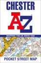
Navigate your way around Chester with detailed street maps from A-Z This up-to-date, folded A-Z street map includes 2,600 streets in and around Brighton. As well as the …
karta, falsad., 2023, Engelska, ISBN 9780008581763
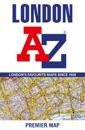
Navigate your way around London with this detailed, easy-to-use, and up-to-date A-Z Premier Map. A full-colour, single sided, fold-out street map, covering a six-mile …
karta, falsad., 2023, Engelska, ISBN 9780008581787
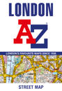
This great value, fold-out map uses our instantly recognisable A-Z street mapping and has handy a TfL Tube map on the back for easy access. Published at a scale of 3.5 …
karta, falsad., 2023, Engelska, ISBN 9780008579999
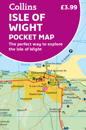
Explore new places with handy pocket maps from Collins. Handy little full-colour map of the Isle of Wight. Detailed mapping and tourist information of the whole island. …