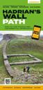
karta, falsad., 2020, Engelska, ISBN 9781839810312
Hadrian's Wall Path Guidemap from Vertebrate Publishing is a lightweight, waterproof, durable and easy-to-use folding map with 1:40,000-scale mapping for the east to west HWP …
karta, falsad., 2020, Engelska, ISBN 9781912046584
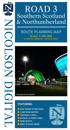
Revised and updated version of our Road Map 3, based on Ordnance Survey 1/250000 data. Covering the south of Scotland from approximately Tobermory in the NW to just south of …
karta, falsad., 2023, Engelska, ISBN 9781851376681
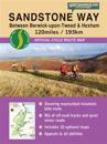
Entire route on one map The Northumberland Coast Path stretches for 103km (64 miles) from Cresswell in the south to Berwick-upon-Tweed in the north, then the Berwickshire Coastal …
karta, falsad., 2019, Engelska, ISBN 9781851374380
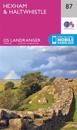
Toughdurable. XT40 - virtually indestructible. Light, compact. Entire route on one sheet. Clear easy to read. Sites of Roman remains. Accommodation and services. Great value for …
karta, falsad., 2019, Engelska, ISBN 9780319475683
Från 245 kr
The OS Landranger Active Map series covers Great Britain with 204 detailed maps, perfect for day trips and short breaks. Tough, durable and weatherproof, covered in a lightweight …
OS Explorer is the Ordnance Survey's most detailed map and is recommended for anyone enjoying outdoor activities like walking, horse riding and off-road cycling. The OS Explorer …