karta, falsad., 2024, Engelska, ISBN 9783707922523
The Road Atlas Scandinavia 1:200,000 - 400,000 is the right companion for all holidaymakers who are traveling by car in the far north and also want to get to know the area to the …
karta, falsad., 2022, Engelska, ISBN 9783707921618
In addition to the clear design, the Norway 1:600,000 road map has a lot of additional information such as road conditions, sights, campsites and various city center maps.
karta, falsad., 2018, Engelska, ISBN 9783707905793
freytagberndt maps are available for many countries and regions in the world. In addition to the precise cartography each map also includes a lot of additional information about …
karta, falsad., 2022, Engelska, ISBN 9783707919936
In addition to the clear design, the road map "Sweden Southeast, road and leisure map 1:250,000, freytagberndt" offers a lot of additional information such as road conditions, …
karta, falsad., 2018, Engelska, ISBN 9783707915129
freytagberndt maps are available for many countries and regions in the world. In addition to the precise cartography each map also includes a lot of additional information about …
karta, falsad., 2023, Engelska, ISBN 9783707921915
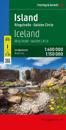
The 1:400,000 scale road and leisure map of Iceland provides a wealth of useful information for travellers wishing to experience the breath-taking beauty of Iceland.
karta, falsad., 2018, Engelska, ISBN 9783707916560
freytagberndt maps are available for many countries and regions in the world. In addition to the precise cartography each map also includes a lot of additional information about …
karta, falsad., 2023, Engelska, ISBN 9783707921953
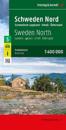
The road map of northern Sweden on a scale of 1:400,000 is ideal for active holidaymakers traveling by car, motorbike or caravan. The widely ramified road network is shown exactly, …