Filter
Navigation & sjömanskap
Filter
The first cruising logbook for navigators of powerboats. Suitable for both planing and displacement craft. Designed to last a full season it allows space for electronic navigation …
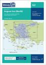
Imray-Tetra charts for the Ionian and Aegean are widely acknowledged as the best available for the cruising sailor. They combine the latest official survey data with first-hand …
Plans included: St-Quay-Portrieux (1:25 000) Binic (1:12 500) Dahouet (1:10 000) Erquy (1:20 000) Saint-Cast-Le-Guildo (1:20 000) St-Malo Approaches (1:55 000) St-Malo (1:17 500) …
50 pages
Plans included: Marseille Vieux-Port & Iles du Frioul (1:35 000) Iles d'Hyeres (1:135 000) Golfe de St-Tropez (1:70 000) Golfe de La Napoule (1:60 000) Antibes (1:15 000) …
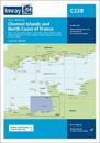
The latest official UKHO data is included, combined with additional information sourced from Imray's network to make it ideal for small craft. The chart has been fully revised …
GMDSS = Global Maritime Distress and Safety System. F/V = Fishing vessel. With carbon copy forms. Supersedes 2000 edition (ISBN 9780115522406)
A modern sailor's logbook, designed to last a full season, it allows space for electronic navigation information and narrative.